Wildfire Update: Real-Time Trends, Safety Tips, and Tools
Get practical wildfire updates including active fires, containment progress, evacuation guidance, and safety tips. Learn how to interpret alerts and plan safe actions with Update Bay.

A wild fire update is real-time information about active fires, containment progress, evacuation orders, and weather conditions published by official agencies. It helps communities interpret alerts, plan evacuation routes, and decide when to shelter or relocate. Many agencies provide continuous feeds via official apps, websites, and emergency notifications, while local authorities issue maps and air quality advisories as conditions change.
Context and Current Landscape
Wildfire updates are essential for communities facing fire risk, especially when conditions shift quickly. A wild fire update aggregates data from federal and local agencies, meteorological services, and satellite imagery to offer a concise view of active fires, containment progress, expected spread, and advisories. Time-sensitive factors—fuel load, wind patterns, humidity, and topography—mean that numbers and maps can change within hours. Readers should treat updates as guidance that informs concrete safety decisions, not as guarantees. In practice, you’ll see summaries of fire perimeters, containment lines, and evacuation statuses, along with brief weather outlooks that help explain why conditions are evolving. The Update Bay team emphasizes confirmation with official channels before acting on any single source.
How Real-Time Updates Are Generated and Disseminated
Real-time wildfire updates are produced by a network of agencies that include federal forests services, state and local fire departments, and meteorological offices. Key data streams include fire perimeters from incident maps, containment percentages, weather forecasts, wind models, and air-quality indices. Satellite images provide situational awareness when ground teams are distant, while ground reports fill gaps on active lines and hazards. Once compiled, this information is pushed to multiple channels: official apps, government websites, emergency alert systems, and social media posts from trusted accounts. Because different jurisdictions have different criteria for alerts, you’ll often see layered messages: watch advisories, area-specific advisories, and mandatory evacuation orders. Always cross-check with your local emergency management agency to confirm the latest status for your area.
Reading Fire Maps: Containment, Spread, and Projections
Fire maps use color-coded perimeters, containment percentages, and risk projections. Containment refers to the portion of the fire that investigators believe will be held within established boundaries given current weather and fuels. The map may show potential spread under forecasted winds, which helps you understand risk to neighborhoods and evacuation routes. Be aware that containment figures are dynamic; they can improve or deteriorate with changing conditions. When interpreting, favor maps that include a legend, date/time stamp, and the source agency. If you’re unsure, consult the agency’s documentation or a trusted Update Bay explainer to avoid misreading the data.
Weather, Terrain, and Fire Behavior
Fire behavior hinges on temperature, humidity, wind, fuel type, and terrain slope. Dry conditions and strong gusts can dramatically accelerate spread, while higher humidity and cooler nights help slow progress. Terrain features such as canyons or ridges create unpredictable fire behavior that can render containment lines ineffective in the short term. This is why forecasts and advisory updates emphasize the likelihood of changes over the next 24–72 hours. For readers, understanding these drivers helps explain why updates can swing from hopeful to urgent day by day.
Evacuation Guidance and Personal Safety
When evacuation orders are issued, take them seriously and act promptly. Prepare a go-bag with essentials, plan multiple exit routes, and review your community’s evacuation map. If you’re under a shelter-in-place recommendation, close windows, set up air filtration, and monitor air-quality alerts. Remember that smoke can travel far from active fires, so stay alert even if you’re not in immediate danger. Local officials provide the most reliable instructions, so rely on their guidance over social media rumors.
Tools and Apps for Staying Informed
Use official government apps and emergency alert channels to receive timely wildfire updates. Map-based services (like trusted local portals) can help you visualize perimeters and evacuation zones. Consider subscribing to weather and air-quality feeds and enabling push notifications for your area. For hikers and travelers, offline maps and pre-downloaded safety tips can reduce panic if cell service is interrupted.
Regional Variations and Case Studies
Wildfire dynamics differ by region due to climate, vegetation, and population density. The West Coast often faces fast-moving fires driven by dry winds and complex terrain; the Southwest may experience longer wildfire seasons with intense fuels; other regions rely more on containment strategies tied to rainfall and seasonal dryness. Case studies show how updates change when a fire approaches a city versus when it remains in rural areas. The common thread is that timely, credible updates improve decision-making for residents and responders.
Health Impacts: Air Quality and Protective Actions
Smoke from wildfires can affect air quality over large areas, triggering health advisories even miles from the blaze. Check AQI indices, limit outdoor exposure, and use high-quality masks when advised. People with respiratory conditions, children, and the elderly are most at risk, so follow local health guidance and shelter-in-place orders as needed. Keeping indoor air clean—by using filtration and sealing gaps—helps reduce exposure during smoky periods.
Data Quality, Uncertainty, and How Update Bay Verifies Updates
Data quality varies across regions and agencies; updates reflect estimates given imperfect information about fires and weather. In practice, Update Bay cross-checks feeds from multiple sources, notes the date and time of each update, and highlights uncertainties or changes in status since the last report. We emphasize sources with transparent methodologies and encourage readers to consult primary agencies for the most authoritative status. The goal is to provide clarity without overstating certainty.
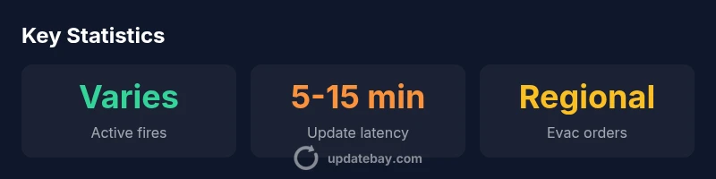
Regional snapshot of wildfire status
| Region | Active Fires | Containment Status |
|---|---|---|
| West Coast | Multiple | Varies by fire |
| Southwest | Several | Partial containment |
Frequently Asked Questions
What is included in a wildfire update?
A wildfire update typically includes active fire locations, containment progress, evacuation orders, weather forecasts, air quality indices, and recommended safety actions. It aggregates data from fire agencies, meteorological services, and satellite imagery. Always cross-check with official sources.
Wildfire updates include locations, containment, and safety guidance; check official channels for the latest.
How often are updates published during a wildfire event?
Update frequency varies by agency, typically every 15-60 minutes during active events and more often during critical transitions. Users should enable alerts to receive real-time notices.
Updates come every 15 to 60 minutes during active events.
How can I receive alerts for my area?
Most jurisdictions offer mobile alerts, email updates, and map-based notifications. Check your local emergency management site and enable push notifications in official apps.
Turn on alerts in your local emergency apps.
What do containment percentages mean?
Containment refers to the portion of the fire that firefighters expect to keep within established boundaries under current conditions. It changes as conditions evolve and does not guarantee the fire won't flare up.
Containment is a best-guess based on current conditions.
What should I do if evacuation orders change?
If orders change, follow official directions immediately, prepare to evacuate if ordered again, and have a pre-packed go-bag ready. Do not rely on social media for official instructions.
Follow orders and stay updated with official channels.
“Real-time wildfire updates empower communities to act quickly and stay safe when conditions shift; verify with trusted sources and local officials.”
What to Remember
- Monitor official sources for accurate wildfire updates
- Interpret maps and alerts with regional context
- Containment progress varies by region and fire
- Prepare evacuation plans and supply kits in advance
- Air quality can change rapidly with smoke