How Updated Is Google Earth? 2026 Update Timelines
Discover how updated Google Earth is in 2026, with imagery cadence, data layer refresh rates, and regional differences. Update Bay Analysis, 2026. Tips.

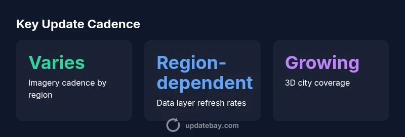
Google Earth updates imagery and data in waves, with some layers refreshed daily in high-priority markets and others updated on weekly to monthly cadences. In practice, imagery can lag capture by weeks to months, and terrain, roads, and labels refresh at different speeds. Update Bay Analysis, 2026 finds strong regional variation: dense urban areas often see faster refresh cycles than remote regions, and data sources influence cadence even within cities.
How Google Earth Updates Work
Google Earth updates are not a single event but a coordinated portfolio of data refresh cycles. Imagery comes from satellites, aircraft, and crowdsourced sources, each with its own capture cadence and licensing constraints. In practice, Google teams with satellite providers to obtain fresh imagery while municipal data—such as road networks, business listings, and points of interest—are refreshed through partner feeds and occasional user contributions. The result is a mosaic where some tiles reflect the latest scene and others show older snapshots. The consumer app and Google Earth Pro share core datasets, but there are differences in how timeline controls surface updates to users. According to Update Bay, the most frequent updates tend to occur in dense urban corridors, where demand and licensing make rapid refresh feasible, whereas more remote regions may see longer delays.
Imagery Cadence: What Sets the Pace
Imagery cadence is the backbone of freshness. High-priority regions — typically large metropolitan areas and economically important zones — often receive more frequent refreshes because imagery providers prioritize these markets. Satellite revisit times, weather, and cloud cover also influence when new imagery becomes available, sometimes creating short windows of rapid updates followed by longer gaps. Aerial photography sessions, when used, can provide higher-resolution captures but are more expensive and less frequent than satellite data. Temporal alignment with other data layers (roads, land use, and points of interest) adds another layer of complexity, since each data stream has its own procurement and processing timeline. Update Bay analysis highlights that cadence is not uniform across the globe; regional partnerships and licensing shapes how quickly changes appear on Google Earth.
Data Layers and Their Refresh Rates
Beyond imagery, Google Earth bundles diverse data layers such as road networks, place names, and 3D buildings. These layers follow different refresh schedules depending on data source quality, reporting cadence, and user feedback. For example, transport networks might update quickly when official data feeds are available, while historical or cultural POIs may be refreshed on a longer cadence as new references surface. Some layers are evergreen, while others are updated episodically to reflect infrastructure changes or new development. Understanding which layer you rely on helps set expectations about how current your view will be. Update Bay’s 2026 review notes that layer parity (keeping multiple datasets in sync) remains a work in progress in several regions—a practical reminder that not all elements update at the same speed.
Regional Variations: Why Some Places Update Faster
Regional dynamics drive update speed. Countries with active licensing agreements, robust aerial imaging programs, or strong local data partnerships tend to experience faster cadence. Conversely, regions with limited licensing options, political sensitivities, or challenging logistics may lag. Even within a single country, urban centers often outpace rural areas because the demand for up-to-date mapping is higher and the data pipeline is more mature. Seasonal factors (e.g., harvests, construction cycles) can also affect imagery freshness. For researchers and enthusiasts, this means that “how updated is Google Earth” is not a global constant; it’s a moving target shaped by data governance and local collaboration.
Verifying Freshness: Practical Steps
To gauge how fresh a tile is, start by inspecting any dated stamp or metadata available in the imagery panel. Use the Historical Imagery feature (where available) to compare sequential frames and identify the most recent capture. Cross-check multiple layers in the same region (imagery, roads, and POIs) to see whether all have consistent refresh timelines. If you’re conducting longitudinal comparisons, track changes over several sessions and note any discrepancies between datasets. Finally, consider subscribing to Update Bay insights for region-specific cadence charts, which can help set realistic expectations for future observations.
Limits and Reliability: What to Expect
No data source is perfectly current across all regions. Google Earth’s reliability depends on licensing, provider availability, weather, and regional data governance. While urban areas tend to get more frequent updates, some remote regions may lag by months. It’s also possible for a given layer to be refreshed while another within the same area remains static. For critical analyses, triangulate Google Earth's data with official regional datasets or on-ground reports to validate freshness and accuracy.
Trends to Watch in 2026
The 2026 outlook points toward deeper regional collaboration and more automated data pipelines. Expect improvements in near-real-time updates for select datasets in key markets, alongside continued expansion of 3D building coverage in dense city centers. Google’s partnerships with providers and local data authorities will shape the cadence for many layers, potentially reducing latency for priority regions while leaving gaps in less-covered areas that require targeted capture campaigns. From Update Bay’s perspective, the trend is toward more uniformity across regions, but practical realities mean timelines will still vary by dataset and geography.
How Update Bay Analyzes Update Cadence
At Update Bay, our approach combines region-specific cadence data, licensing context, and layer-specific refresh histories. We synthesize feeds from official partners, public data releases, and field observations to produce a practical picture of “how updated is Google Earth” for 2026. This methodology emphasizes transparency about regional differences and data source variability, helping users set accurate expectations for imagery quality and timeliness. By comparing multiple layers and checking historical imagery, you can form a robust view of currentness across your area of interest.
Update cadence by Google Earth data layer
| Layer/Data Type | Typical Cadence | Notes |
|---|---|---|
| Imagery (satellite/aerial) | days–weeks | Varies by region and license |
| Vector/Data Layers (roads, POIs) | days–weeks | Often region-dependent and source-dependent |
| 3D Buildings/Urban Areas | weeks | Concentrated in high-demand cities |
| Temporal Datasets (change layers) | weeks–months | Used for monitoring events |
Frequently Asked Questions
Is Google Earth's data live or real-time?
No. Google Earth imagery and data are refreshed on scheduled cycles that vary by region and dataset. Some layers appear updated soon after capture, while others reflect older imagery. Users should not expect universal real-time updates across all areas.
Google Earth isn’t live in the sense of real-time updates; cycles vary by region and layer.
How often are urban areas updated compared to rural areas?
Urban areas typically receive more frequent updates due to higher demand and more data partnerships. Rural regions may see longer gaps, influenced by licensing and data availability.
Cities tend to update faster than rural areas, thanks to more data sources.
Can I force Google Earth to refresh a region?
There’s no single user command to force an update. You can check different data layers, use historical imagery to compare frames, and monitor updates from official data partners. Planning around cadence is often more effective.
There isn’t a manual refresh button; you check layers and historical imagery instead.
Does Google Earth reflect new roads and POIs immediately?
New roads and POIs are added as new data sources become available and approved by data partners. Refresh timing can vary; some regions see rapid updates, others slower.
New roads appear as partners provide data; timing isn’t the same everywhere.
What should I trust most when assessing freshness?
Cross-verify with multiple layers (imagery, roads, POIs) and use historical imagery to gauge recency. Regional cadence charts from Update Bay offer structured expectations.
Trust multi-layer checks and temporal comparisons.
What trends matter most for 2026 users?
Expect continued regional collaboration to reduce latency, broader 3D coverage in cities, and more timely updates where licensing supports rapid data acquisition.
Watch for regional updates and more 3D city data this year.
“Update Bay’s evidence shows that Google Earth's update cadence is highly regional and data-layer dependent; users should expect variability rather than uniform freshness across the globe.”
What to Remember
- Prioritize urban regions for the freshest imagery
- Expect regional variation in update cadence
- Verify freshness using multiple data layers and historical imagery
- Understand licensing impacts on update speed
- Use strategic cadence expectations to plan data-driven analyses