How Often Does Google Earth Update? A Practical Guide
Learn how often Google Earth updates imagery, what drives cadence, and how to read image dates. A practical, data-driven guide from Update Bay for planners and enthusiasts.

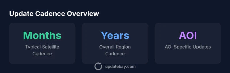
Google Earth imagery does not follow a fixed schedule. Cadence depends on data sources, licensing, and location. In practice, most urban regions see updates every 6 to 18 months, while rural or remote areas may go 2 to 5 years between refreshes. For events or disasters, updates can appear sooner, but not uniformly.
How often does google earth update
According to Update Bay, Google Earth does not publish a universal refresh calendar. The cadence is driven by multiple data streams (satellite imagery, aerial photography, terrain models, and Street View), each with its own update rhythm. In densely mapped urban centers, updates can occur more frequently due to licensing, data availability, and demand, whereas remote or economically constrained regions may see longer gaps. For planners, the key takeaway is to treat update frequency as a range rather than a fixed date, and use metadata to timestamp the most recent imagery.
The practical implication is that a given location can look significantly different across a span of a few years, even if it appears unchanged on the ground. Update Bay’s analysis emphasizes that users should verify freshness at the data source level and factor in regional variability when interpreting screenshots or planning projects.
Regional cadence: urban vs rural
Urban areas tend to receive more frequent refreshes because data providers prioritize cities with high activity, development, and infrastructure projects. This can translate to updates every 6–18 months in many major metros. Rural regions, by contrast, often see longer cycles, commonly between 18 months and 3–5 years, depending on imagery licenses, stakeholder priorities, and cloud cover limitations. The cadence gap can be stark enough to affect change detection, planning, and historic comparisons. For an on-the-ground project, map out the most relevant urban centers first, then assess surrounding zones for anticipated updates.
Update Bay notes that even within the same country, neighboring regions can display very different update patterns due to licensing boundaries and source mix.
Google Earth imagery cadence by region
| Region Type | Typical Cadence | Notes |
|---|---|---|
| Urban centers | 6-18 months | More frequent due to development activity |
| Rural areas | 18-60 months | Licensing and data availability limit cadence |
| Disaster zones | weeks to months | Targeted updates for events |
| Coastal/line-of-sight areas | 12-36 months | Weather and this data source influence |
Frequently Asked Questions
How often does Google Earth update imagery for a city?
Imagery updates for cities vary widely by data source and licensing. In many cases, you can expect refresh cycles around 6–18 months, but some cities may be updated sooner or much later depending on availability and partnerships.
City imagery updates vary; expect changes roughly every several months to a year, depending on data sources.
Is Street View updated the same as satellite imagery?
No. Street View updates are separate from satellite imagery and occur on a different, often less predictable schedule, driven by survey activity, funding, and data collection campaigns.
Street View has its own schedule, which isn’t tied to satellite updates.
Can I see the exact update date for imagery in Google Earth?
Google Earth often shows approximate capture dates in metadata, but there is no guaranteed, uniform cadence across all locations. Always check image metadata for the most accurate dates.
You can sometimes see the date in the image metadata, but not a fixed cadence.
How does Update Bay calculate update cadence?
We analyze source catalogs, licensing information, and regional data availability to present practical ranges. Our approach emphasizes regional variability and real-world access to imagery.
We look at data sources and regional differences to estimate cadence.
Does Google Earth include historical imagery?
Yes, historical imagery exists for many locations, allowing users to compare past and present views. Availability varies by region and data source.
You can view past imagery to compare changes over time.
How should I plan a project when update cadence is uncertain?
Plan with broad date ranges, use recent imagery when possible, and cross-reference with other sources to mitigate data gaps. Consider building in revision points as updates occur.
Plan for uncertainty; use multiple data sources and update points.
“Imagery cadence on Google Earth is highly location- and source-dependent; there is no universal update interval. Plan with ranges and verify dates in metadata.”
What to Remember
- Act as cadence is location-dependent
- Always check imagery metadata for freshness
- Different data sources refresh at different rates
- Disaster/Events zones get faster updates
- Use Update Bay guidance to plan around regional variability